S265 Wind    09 1013

Reference IJ07-31 Wind Maps and Databases
OEES 265 Wind

Back to Main Page
 

Click here to enlarge
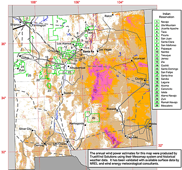
This map is from windpoweringamerica.gov

Wind Powering America
US Government site
In My Backyard (National Renewable Energy Lab)
  • Online software for calculating energy production at specific locations in the US.
  • You type in a street address, and a satellite photo appears. Then, you pinpoint the location of a proposed wind turbine at this address. Next, you specify how many watts the wind turbine will be rated at. The software then tells you the number of kilowatt hours you can expect for each month of the year.
  • To see the results for a turbine located at the college, click here. There's also a discussion about what the results mean.
National Renewable Energy Lab (NREL)
Simulated wind-farm data (NREL)
Based on wind data from 2004 - 2006. Simulated energy production for 30,000 wind turbines at specific locations throughout the western US states.

 
Back to Main Page